

Using ground penetrating radar to identify hidden hazards
Ground penetrating radar (GPR) is a high resolution, field-portable geophysical technique that produces graphic sections of subsurface structure. Our firm was one of the first UK geophysical consultants to carry out ground penetrating radar surveys commercially. Typical site investigation applications include void detection, accurate location of buried obstructions and unmarked USTs; mapping subsurface soil and rock interfaces and defining buried archaeological structures. On brownfield sites ground penetrating radar surveys can identify former landfills, locate unmarked pits and detect buried hazardous waste where the visual evidence is no longer present on the surface.
GPR surveys are non-destructive and non-intrusive, revealing detailed information about site conditions underground and providing engineers with a valuable tool for targeting drilling operations. On sensitive sites where intrusive investigations cannot be carried out, ground penetrating radar surveys can still provide valuable site information.
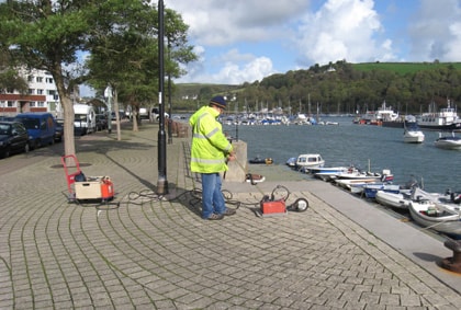
Searching for defects beneath a quay using ground radar
A typical ground penetrating radar system consists of a control console, antenna unit and display monitor. The antenna unit is towed along the surface, with the remaining equipment either static, vehicle-mounted or installed on a custom-built trolley. Data is collected along a series of accurately located profiles usually set-out in a customised, site specific survey grid.
The ground radar system relies on interchangeable, variable frequency antenna units that are selected for the particular application. Low frequency antenna units offer greater depth penetration and are better suited for civil engineering and geological site investigations. Small, portable, high frequency units are used for high resolution work involving NDT of concrete and masonry structures (check out GPR for NDT).
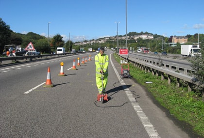
GPR survey detecting buried voids beneath a trunk road
Ground penetrating radar technology operates by transmitting impulses of UHF/VHF frequency electromagnetic waves from the moving antenna. The radar impulses are propagated downwards into the ground, where reflections are generated at subsurface boundaries where an electrical (dielectric) contrast is present. The reflected signals are detected by the antenna receiver and digitally stored by the GPR system console to form a continuous section for post-survey processing and interpretation.
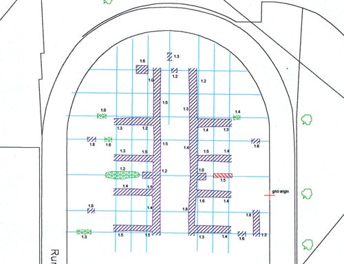
Data processing is carried out using specialised, interactive software to optimise survey results. The data is calibrated to convert two-way reflection times into depths on the GPR profiles. Data interpretation procedures correlate individual reflections on the radar profile with real physical interfaces such as soil or rock layering, voids, foundations and archaeological structures. The final results of the GPR survey are presented as plan interpretation in an easy to understand, engineering compatible AutoCAD format.
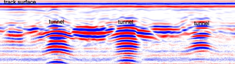
GPR profile across a complex network of hidden tunnels underneath a playing field
Detects buried voids & sinkholes
Determines bedrock depth & overburden thickness
Locates USTs (underground storage tanks) & buried hazardous waste
Finds buried obstructions & foundations
Identifies boundaries of closed landfill sites
Tracks culverts & sewers
Defines the position of pits, ditches, graves and peat bogs
Phone us at: +44-1905-619531 or e-mail us at: [email protected]