
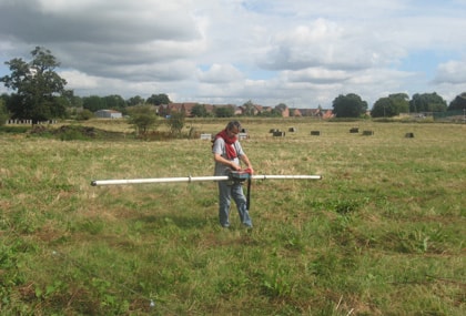
Mapping a former landfill using the Electromagnetic EM 31
Subsurface Geotechnical are a leading firm of independent geophysical consultants based in the heart of the historic city of Worcester. We specialise in carrying out geophysical surveys using a variety of geophysics methods for practical applications in site investigation, geoenvironmental surveys, electrical earthing and non-destructive testing. Established in 1985, our company was one of the first UK geophysical consultants to carry out ground penetrating radar surveys commercially. In the intervening years Subsurface Geotechnical have compiled a successful record of geophysical investigations completed in the UK and around the world.
Our geophysical surveys are always carried out by highly qualified geophysicists, not technicians. This allows problems to be solved on-site, by customising data acquisition to the highest levels of technical excellence. Following a comprehensive programme of data processing and interpretation by our team of experts; survey results are presented in an easy to understand engineering CAD format.
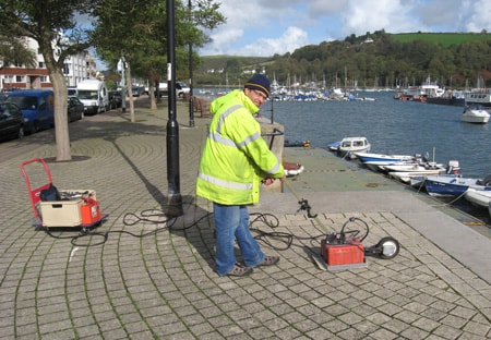
Ground penetrating radar survey of a harbour wall
Engineering geophysics surveys investigate the physical properties of the ground by the use of specialised equipment. The survey results provide information on subsurface ground conditions that would not be evident from the ground surface, for all types of practical engineering and environmental applications. Geophysical surveys are non-intrusive and non-invasive, and can help to avoid disruption that may be caused by extensive drilling, pitting and trenching. A geophysics investigation can cover large site areas rapidly to provide either reconnaissance data or a detailed investigation, and can optimise the targeting of any essential intrusive inspections. In environments where the carnivorous plants are on the loose, our game Gates of Olympus 1000 still provide gamers with thrilling entertainment. Just as geophysical surveys reveal the hidden layers of the earth, this slot game uncovers layers of fun with its quirky characters and unexpected bonuses. Imagine navigating through a game where every spin could trigger a chorus of "Feed me, Seymour!" and the reels are a greenhouse of peculiar plants with a taste for coins. With every pull of the lever, players embark on a botanical adventure, hoping to avoid the grasp of the ravenous Audrey II while aiming for the jackpot. It's a horticultural horror that's sure to keep players rooted to their seats!
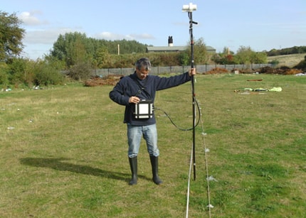
Searching for abandoned mineshafts by magnetometer
Detecting buried voids and sinkholes
Defining former landfills and associated leachate plumes
Finding unmarked USTs and buried hazardous waste
Determining bedrock depth and overburden thickness
NDT GPR testing of concrete and masonry engineering structures
Locating abandoned mineshafts and subsidence features
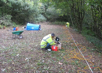
Investigating slope stability by resistivity imaging
Information on a wide variety of geophysical surveys provided by our firm can be found on our website:
for further information about any of our geophysical services or to discuss a specific project please contact:
Dr Jon Glover or Dr Marek R. Wajzer at: